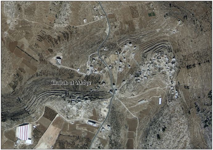
Hadab al-Alaqa
Hadab al-Alaqa
حدب العلقة | |
|---|---|
| Hadab al-Alaqa, Hebron | |
| Country | Palestine |
| Governorate | Hebron Governorate |
| Area | |
• Total | 1,100 dunams (1.1 km2 or 300 acres) |
| estimate[1] | |
| Elevation | 764 m (2,507 ft) |
| Population (2007)[1] | |
• Total | 641 |
Hadab al-Alaqa is a village in the area of Dura, in the Hebron Governorate, in the southern West Bank. It is located 12 kilometres (7.5 mi) southwest of the city of Hebron.[1][2][3]
Geography
It is bordered to the east by the villages of Abda and al-'Alqa al-Fuqa, to the north by as-Sura, to the west by Deir al-Asal al-Tahta and Iskik, and to the south by Karza.
History
Modern history of the village dates back to 1948, when Palestinians fleeing villages destroyed during the Nakba established Hadab al-Alaqa. The word Hadab, meaning high place in Arabic, came from its location on top of a mountain. As of 2009, 98% of the village's residents were from Al Awawda Family, with the remaining being from the Abu Aharar and al-Darabi’ families.[1]
Population
In 2007, according to the Palestinian Central Bureau of Statistics, the population was 641.[1][4][5] As of 2009, the village had one mosque. As of the 2006-2007 school year, it had one seven-classroom school, Al Beyader Elementary Co-education School, with 123 students and 12 teachers.[1]
See also
References
- ^ a b c d e f g "Hadab Al 'Alaqa Village Profile" (PDF), Palestinian Localities Study, Hebron Governorate, The Applied Research Institute - Jerusalem, 2009
- ^ http://vprofile.arij.org/hebron/ar/pdfs/hadab_alalaqa_pro_ar.pdf
- ^ "Riwaq: Home". www.riwaq.org. Retrieved 2025-05-18.
- ^ "عدد السكان المقدر في منتصف العام لمحافظة الخليل حسب التجمع 2017-2021". www.pcbs.gov.ps. Retrieved 2025-05-18.
- ^ "دائرة الخليل الانتخابية". WAFA Info. Retrieved 2025-05-18.